Since we saw a good weather window opening up over Mount Taranaki we decided to pack up, leave the Thirties scenes of Napier behind us and drive across the country for some volcanic hiking.
On the way we discussed going to the top versus a more calm walk lower down. Mount Taranaki is New Zealand's second most deadly mountain, mostly because of sudden changes in the weather, and officially you are supposed to be fairly experienced and armed with crampons to do it.
The men from our grumpy Dutch guidebook apparently disregarded this advice, were very grumpy about the state of the tracks, and turned back before they reached the summit. But it was supposed to be sunny all day, and wouldn't it be cool to get to the top? Are we true peak grabbers or not? As we deliberated in the car on the way there, we could only see an angry grey cloud where the top was supposed to be.
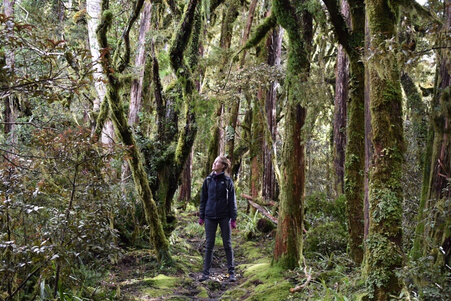
Mount Taranaki is in the middle of a national park that looks like a perfect green circle on the map, surrounded by farmland. The border is very clear: on the way all you see are green hills with sheep and cows, and then you suddenly duck into a jungle tunnel. After climbing up bend after bend past ferns and trees, we reached the visitor's centre, just in time to talk about the tracks before it closed.
‘Well, there is a lot of snow and ice now, and there's no point in trying to go to the top if you don't have poles, ice axes, crampons and helmets’ said the lady. She looked as if she didn't think we were the type of people to have poles, ice axes, crampons and helmets in the back of our old van. We were not. Sensible walk it was.
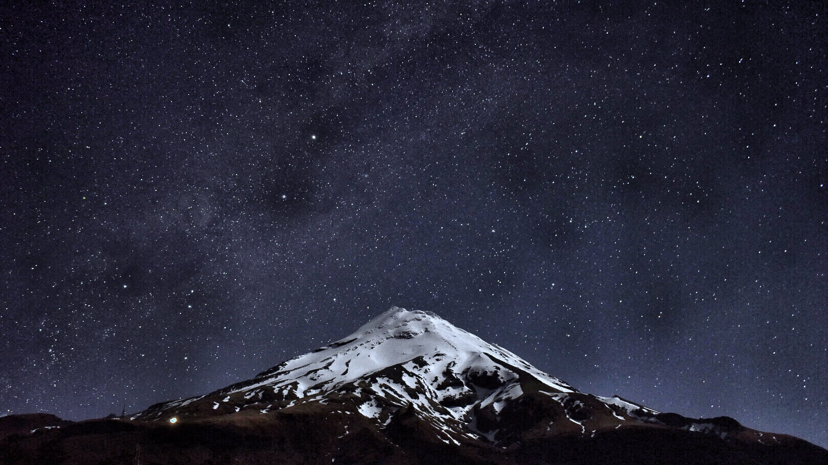
The lady did have some good news: the visitor centre car park was a free camping area with toilets, so we could spend the night next to the mountain. It was a nice change from our previous locations closer to main roads, and we only had a couple of neighbours. By early evening the clouds had cleared and we could finally see the mountain. And as it got dark the moon and stars got very bright so we could keep seeing the mountain, if not for the sudden severe cold. It is possible that we had underestimated how close New Zealand spring is to winter. Especially at altitude.
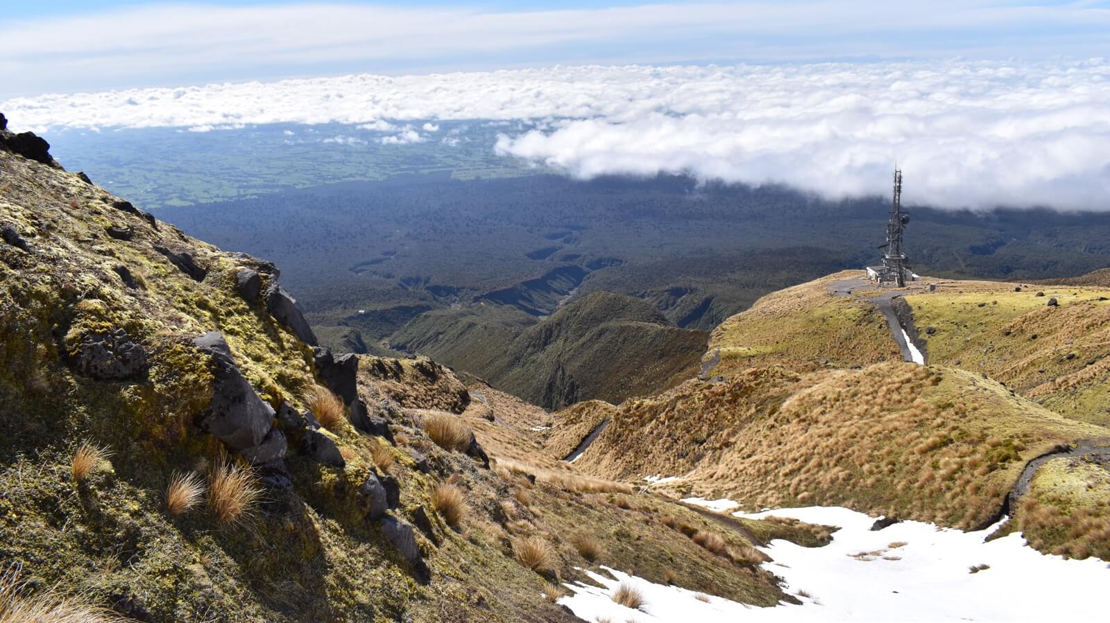
The next morning was almost completely clear, as promised by the various weather reports we now religiously follow. We had decided to walk up to a telecom tower and lodge, as the lady had told us it would be safe to go that far, and we thought we'd be able to assess the state of things when we got there. We passed the odd patch of snow on the side of the path there but made it up in just over an hour - easy. With the weather looking pretty good and having not really reached the snow line yet we decided to hike up a bit higher.
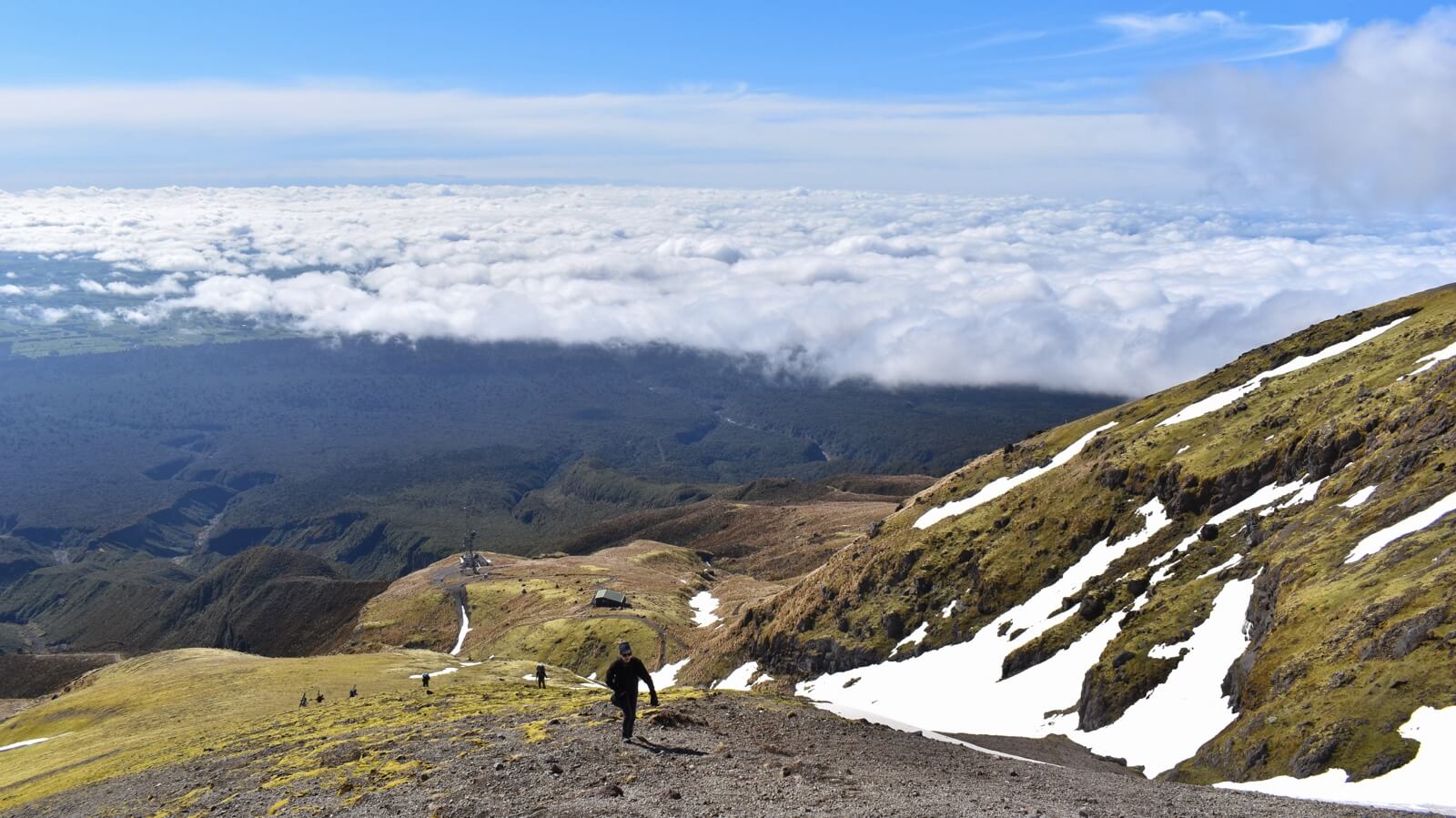
For a while we felt pretty hardcore being the only ones hiking around on the mountain, until we ran into some skiers who were climbing up (in ski shoes, with skis strapped to their backs!) to be able to ski down. When we had to actually cross snow that was in our path, our own experience was not a complete success. Still, we made it a couple of hundred metres above the lodge and it felt good to look back and survey the view. From up there you could see that the map didn't lie - the national park forms an almost perfect circle.
After hiking back down to lodge level, the path around the mountain was otherwise pretty doable, and we had some great views of the mountain, the national park, the countryside and sea beyond. To turn back to the van, we had several choices. Distances on these trails are written in hours, and the accuracy of these estimations exponentially increased the longer the time is. ‘1 hour’ means: ‘if you are in a weighted wheelchair trying to bring a donkey’, whereas ‘6 hours’ means: ‘if you are lucky’. We chose the longer path hoping we could shave off a few hours and be back in time for some coffee in the cafe, and we only made it back just in time to be able to hide from a sudden hail shower. Sudden weather changes indeed, but we survived the day in one piece with some additional muscle aches and photos.
We have now headed back to the Tongariro area for some cleaning, charging, and walking in the Mount Doom vicinity. Weather allowing we'll even do the Tongariro crossing, but we won't get our hopes up too much. The mountain itself has just teasingly showed a glimpse of itself: clearly it is just playing with us.